The Research Plan: Sebastiaan Willemen & Lola Daels
This interview is part of a series of interviews conducted at the start of Fieldwork II. They offer a glimpse into the practice of the six participating artists/collectives and explore how they are approaching their research projects. You can also follow the rest of their journey on this website. Here, Lola Daels and Sebastiaan Willemen discuss their project 'STUWLAND - Landscapes of infrastructure'.
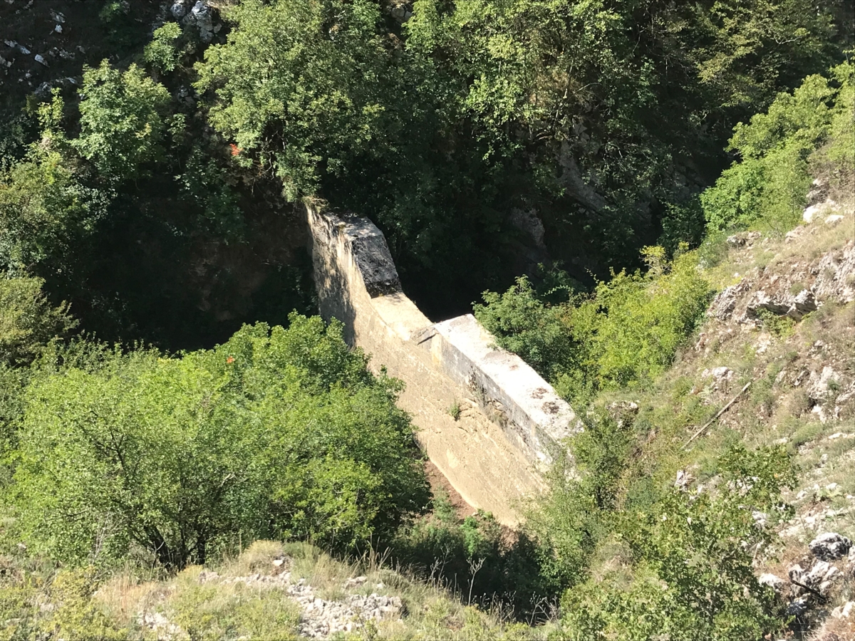
During residencies in Marrakech and Tehran, we already investigated the role of water infrastructure and its influence on society. Drought is a much more decisive factor there than it is here. The systems for transporting water and supplying cities have been a crucial part of these societies since time immemorial. STUWLAND, our project for Veldwerk, came about during a walk we took in the Abruzzo region of Italy. There we came across the concrete remains of what was once a dam. The structure was overgrown and seemed to have been absorbed by its regenerating natural environment over the years. This phenomenon made us think about what bizarre and radical infrastructures these dams are. We thought back to our childhood and now realised why reservoirs always gave us a strange feeling. The bare banks and sloping forests that abruptly plunge into the artificial lake are everyday recreational areas that people don't think twice about. Yet they are megastructures that embody the human urge to control their living environment. However, the ruins of the dam in Italy showed us the transience of this ever-changing relationship between humans and nature. During the same summer that we took our walk in Italy, disastrous floods occurred in our country. A water dam in Eupen nearly collapsed at that time. This only made our research more urgent.
Our first steps in a research project are very specific to our individual practices. Sebastiaan spends hours on Google Maps and Earth, searching for interesting landscapes and infrastructures. When he finds them, whether in Egypt or the Pajotteland, he delves deeper into their surroundings and history. Lola starts with objects she finds, for example on the street. She investigates their context and studies their materials. Projects we set up together often start with walks we take together. We are both very curious, and that takes us to new places. During residencies or trips, we often walk around for hours to get to know our surroundings. During those walks, as this project within Veldwerk illustrates, something catches our eye, something we can't stop talking about and for which we ultimately seek and hopefully find a form so that we can investigate it further.
When such a collective fixation arises, we try to establish contact with experts in the field. These may be people who, for example, come into daily contact with the object or phenomenon we are currently interested in, but also scientists or theorists. In the case of this research into dams, it is impossible to take an unambiguous position, which is why these various discussion partners are so important. The impact of dams on the landscape and on society is very complex and can be approached from different perspectives. On the one hand, there is the landscape and scientific perspective. On the other hand, we want to investigate the human relationship with the infrastructure. In order to address the different layers of the dams, we therefore want to engage in dialogue with different profiles. Our list of potential interviewees includes residents living on and around the dam, as well as landscape architects, historians, energy experts, policymakers and artists.
In order to explore the human relationship with the dams, we will soon be setting off on a seven-day cycling tour from dam to dam. Among other things, we want to find out how people feel about being so close to such a mass of water, whether they still know people who witnessed the construction of the dam, and whether the recent floods have changed their relationship with the dam.
What does the term 'rural area' still mean today? In Belgium, it has become almost impossible to determine where a city begins and where it ends. However, when you look for the mechanisms that keep the city running, for example by supplying it with raw materials, food or, as in our project, energy, you quickly end up in what we might call rural areas. In the past, rural areas were often ignored by urban planners, and despite a recent catch-up movement, they still only form a marginal part of the debate. Yet it is here that the biggest climate problems need to be tackled. Protecting our soils and groundwater levels does not happen in the city but in the countryside. The nitrogen crisis in Flanders is another example of this. That is why we want to focus more and more in our artistic practices on these supply areas and on the infrastructures and metabolisms that make our living environments function.
No matter how interested we are in the conceptual, there is always a visual aspect involved for us. We try to understand the dams not only conceptually, but by making (digital) models of them, drawing them, photographing them or literally mapping them, we also try to really get to know them. We also collect existing images, such as fascinating images of villages that are exposed when a reservoir dries up due to drought, or a calendar made by an amateur dam enthusiast of the Bütgenbach dam. These different images bring together mapping, visual research and documentation. It is not our intention to take a position for or against dams. As with most things, the ideal situation probably lies somewhere in the middle. However, it would be fantastic to be able to build an installation or present the conversations we had during this research in some way.